Where does Cardiff end? Where does it begin?
Until yesterday, only the geographers cared. Now that the Senedd is putting us into local lockdown, however, the county boundary line has suddenly become of vital importance. For three hundred thousand people, it marks the outer limit, the pale beyond which we are trespassing into the equally COVID-stricken counties of Caerphilly, Newport and Rhondda Cynon Taf, as well as our healthier neighbours in the Vale of Glamorgan.
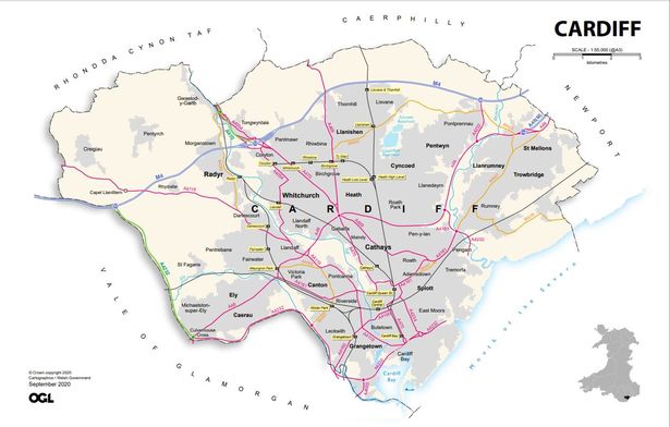
It’s roughly accurate to say that Cardiff is bounded on the south side by the Bristol channel, to the west by the river Ely and the A4232, and to the east by the edge of the suburb of St Mellons, just off junction 30 of the M4. To the north things are less defined, with the boundary generally running a kilometer or two north of the M4 corridor.
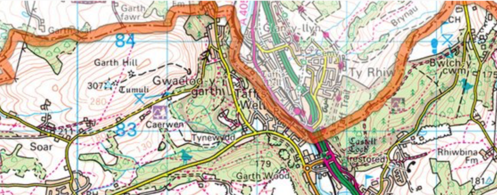
For walkers and Victorian-Gothic castle enthusiasts, this is good news: it means that both Garth Hill and Castle Coch are within the Cardiff county boundaries, as is the Museum of Welsh Life in St Fagans. The greatest losers are the residents of Taff’s Well, where one bank of the Taff is in Cardiff and the other is Rhondda Cynon Taf, meaning that like East and West Berlin, the town is now divided by a hard border.
Cardiff residents are also losing access to their favourite seaside retreats, Penarth and Barry Island. Here the border, running along the River Ely, cuts Cardiff off from the marina along the southern bank and runs directly through the locks of the Cardiff Bay Barrage, meaning that the popular running/walking/cycling loop of the bay is theoretically out of commission.
With the lockdown commencing at 6pm on Sunday, how porous these borders will prove to be remains open to question. Unlike the national lockdown in March, residents are allowed unlimited amounts of outdoor exercise, meaning that keen walkers or cyclists might like to revive the ancient custom of beating the bounds, or tracing out the county line on foot.
